This page as a PDF-Dokument? Simply click on the symbol and wait a few seconds... ---> |
MK-GPS V3 |
See also: MikroKopter-modules

Inhaltsverzeichnis
Shoplink: MKGPS V3
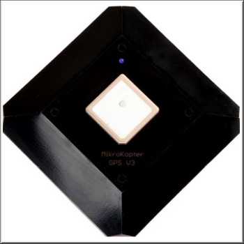
MKGPS V3
The MKGPS V3 is a new GPS-Receiver for the Mikrokopter. It can receive and evaluate in parallel also the Russian GLONASS or the Chinese BeiDou satellite system in addition to the usual American GPS satellites. This increases, particularly in areas with inadequate GPS coverage or signal shading (mountains, high-rise buildings), the satellites availability for navigation, considerably.
For suppressing external interference sources (such as video transmitter), the GPS receiver has been equipped with an RF preamplifier and a high-frequency SAW filter.
(INFO: MKGPS V3 can be used since software version V2.08 for FlightCtrl and NaviCtrl => Download)
Together with a NaviCtrl:
- the position can be held (Position-Hold or PH)
- it can be flown back to the start point (Coming Home or CH)
the flight route can be logged on SD card
the actual position can be displayed on the 'OSD'-Map in the KopterTool
distance and speed can be displayed in the Graupner HoTT-Telemetry
the camera can be focused to a specific point: PointOfInterest (POI)
Video: Assembling Set Navigation
Features
Glonass / BeiDou
The main difference to the old MK GPS V2 is, that besides GPS the Russian system Glonass and the Chinese Beidou system are also supported. In this way a much higher satellite coverage is guaranteed. Especially in areas without adequate GPS coverage (i.e. in valleys), it brings significant improvements.
GPS Info
Via the Koptertool can be displayed:
- the actual GPS divergency (MK need to stand on the ground)
 the center position can be moved by right-clicking
the current signal strength of the satellites
(Note: outside, at least one satellite should have 50dB signal strength.
A GPS-Shield is recommended for a better reception.)- Position of the satellites in the sky:
- light-green satellites: Sat. is used with SBAS-correction data for the navigation
- dark-green satellites: Sat. is used without SBAS-correction data for the navigation
- turquoise satellites: Sat. is not used yet for navigation
- red satellites: signal is bad or Sat. is not useable
- lila satellites: transmits SBAS-correction data
GPS Navigation-Satellites have the letter "G", SBAS-Satellites "S".
The number is the ID of the satellite (PRN Code).
Details about the satellite is also be shown by moving the mouse over the satellite.
![]() Note: If that is in use, the KopterTool directly accesses the GPS module and the NaviCtrl reports "Error: No GPS Communication"
Note: If that is in use, the KopterTool directly accesses the GPS module and the NaviCtrl reports "Error: No GPS Communication"
Amplifier with SAW Filter
The receiver has been equipped with an RF preamplifier and a high-frequency SAW filter. This filters interferences from video transmitter.
External Compass
You can glue the external compass from below into the module - the appropriate spot is intended.
NMEA
Since the software version 2.00a for the NaviCtrl the NMEA format also can be given via the Ublox module.
(i.e. for cameras with data-logging)
The data can be taken via the Debug connection PIN9 at the NaviCtrl.
IMPORTANT: Only with a plugged in microSD-card (max. 2GB / FAT16) into the NaviCtrl the NMEA data can be used.
A file "settings.ini" will be automatically created from the NaviCtr, that provides the required parameter.
If a microSD-card has been already used in the NaviCtrl, the existing Settings.ini must be deleted after a software update, so that a new one can be created with the required parameter.
See also:
LED Status |
|
CAM or EXT1 or EXT2 |
Ereignis |
|
|
|
Schaltausgang nicht aktiv |
|
Schaltausgang aktiv |


